Question.
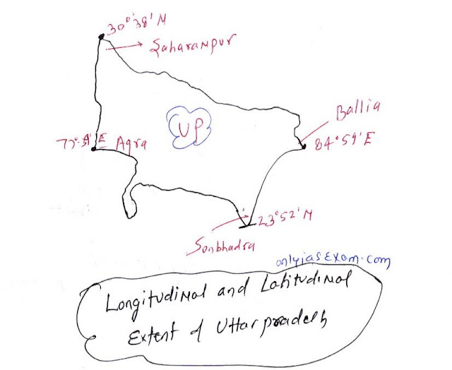
Find out the longitudinal and latitudinal extent of your state [ Uttar Pradesh ].
( Chapter - 1 India – Size and Location, Cass 9 NCERT Contemporary India -I )
Answer.
In terms of geographical area, Uttar Pradesh is the fourth largest state in India after Rajasthan, Madhya Pradesh, and Maharashtra. The area of Uttar Pradesh is about 240,928 sq km, which is about 7.3 percent of the total geographical area.
Uttar Pradesh lies completely north of the Tropic of Cancer (23.5-degree latitude).
The longitude and latitude of Uttar Pradesh are as follows:
Latitudinally Uttar Pradesh lies between 23°52'N and 30°38'N latitudes. The southernmost latitude of Uttar Pradesh (23°52'N) is located in the Sonbhadra district and the northernmost latitude of Uttar Pradesh is located at 30°4'N in the Saharanpur district of Uttar Pradesh.
Longitudinally Uttar Pradesh is located between 77°39' East and 84°59' East. The westernmost longitude (77°3′ E) of Uttar Pradesh is located in the Agra district. The easternmost longitude of Uttar Pradesh (84°59'E) is located in the Ballia district.
You may like also:

ConversionConversion EmoticonEmoticon